GridJet Oy FI.SPO-AUTH.0002 is a company specialized for district heating pipeline survey with helicopter and infrared camera, searching and localisation of groundwater and powerline inspections. Our operative area covers Finland, Estonia and Latvia.
Thermography of district heating networks
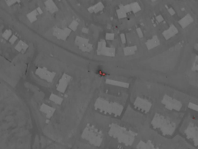
Our enterprise has long-term experience in photographing district heating networks with a thermal camera. With the Flir thermal camera, using the newest detection technology, and special optics, we are also able to determine the situation of district heating networks from up to 300 metres flight-height. Customers will receive an exemplified analysis of fluctuation in temperature in the district heating network, compiled with the help of Flir after-treatment software.
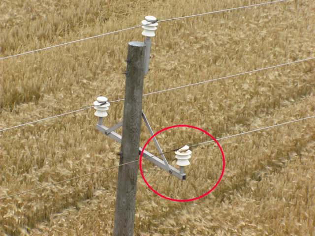
Powerline inspection flights
With the help of professionally and regularly conducted check-flights, the current situation of power network can be mapped in a fast and reliable way. On the basis of the check-flights, we compile for the customer documentation with detailed visual pictures and map extracts, which include all necessary data for evaluating the current situation of the networks and implementing maintenance measures.
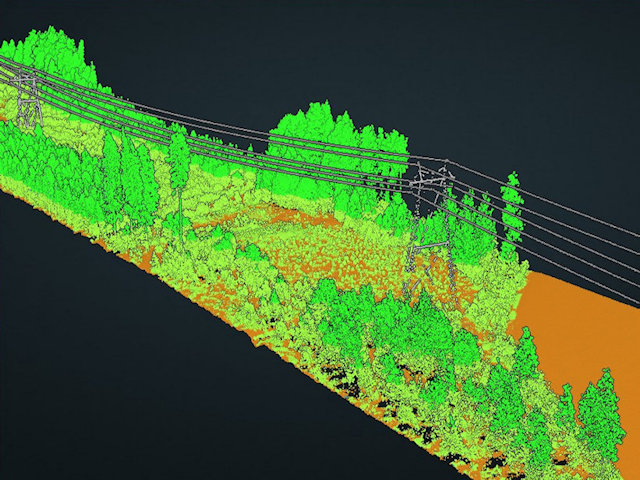
Powerline laserscanning
Vegetation is one of the leading causes of power outages and blackouts. In our experience, environmental factors account for up to 80% of outages. Laserscanning solution provide accurate data regarding: *Vegetation location, height, and risk classification *Tree location and risk classification *Ground, structure, road, railway, bodies of water, and other network locations and/or risk classifications
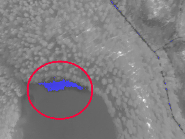
Searching and localisation of groundwater
We conduct flights for mapping the state of groundwater with a thermal camera. Our clients include, for example, different water enterprises, engineering bureaus conducting groundwater surveys and geologists. With the high-resolution Flir thermal camera and subsequent analysis, we can localise in a reliable way the areas on landscape where groundwater is located near the ground. The efficient capability of the camera to differentiate temperatures enables detecting groundwater sources also in lakes and the coastal waters of rivers.